
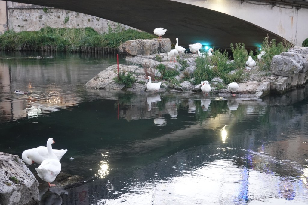
I went for a walk after dinner last night along the banks of the Velino River that runs through Rieti. At night, the ruins of the Roman bridge become a popular roosting spot.

I was going to get a panino from the supermarket but I was too early and nothing was open. There’s an old pilgrim saying, ‘the road will provide’ ( lunch in this case ) and so it was to be.
Today’s walk starts out almost flat. I walked up the ever narrowing valley of the little Turano River. Luckily there was a track, as the road was very busy.
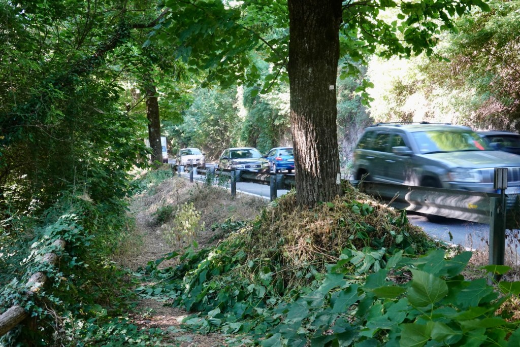
The path split off this busy road and continued along quiet country roads .


I’m so absent minded that I’m always missing turnoffs. I’ve been using Wikiloc which beeps when I’ve gone the wrong way. This turn had 3 signs including the big round one and still I missed it.

After about 10km, the path changes dramatically. Ahead are the hills I have to climb.
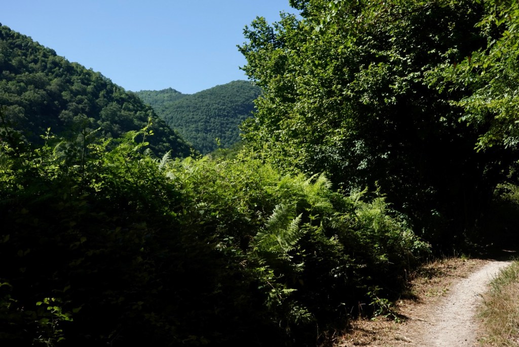
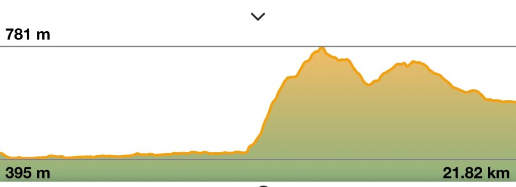
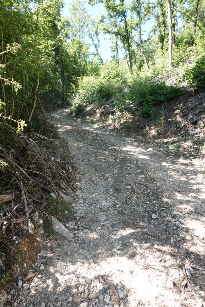
I found it tough going. There was a continuous steep climb up almost 400 metres over about 3km. I stopped regularly to let my heart slow down a bit. To make it more difficult, there were lots of loose slippery stones.
When I got to the very top, I found that there was a little town there! Somehow this hadn’t registered when I read the days’s description in the guidebook last night.


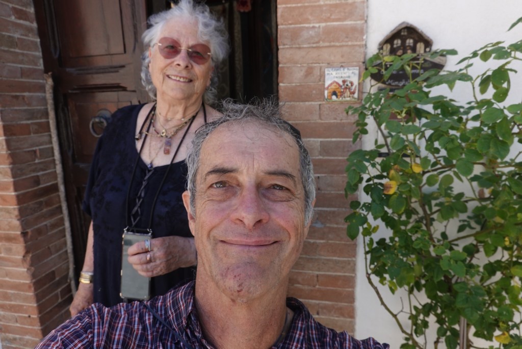
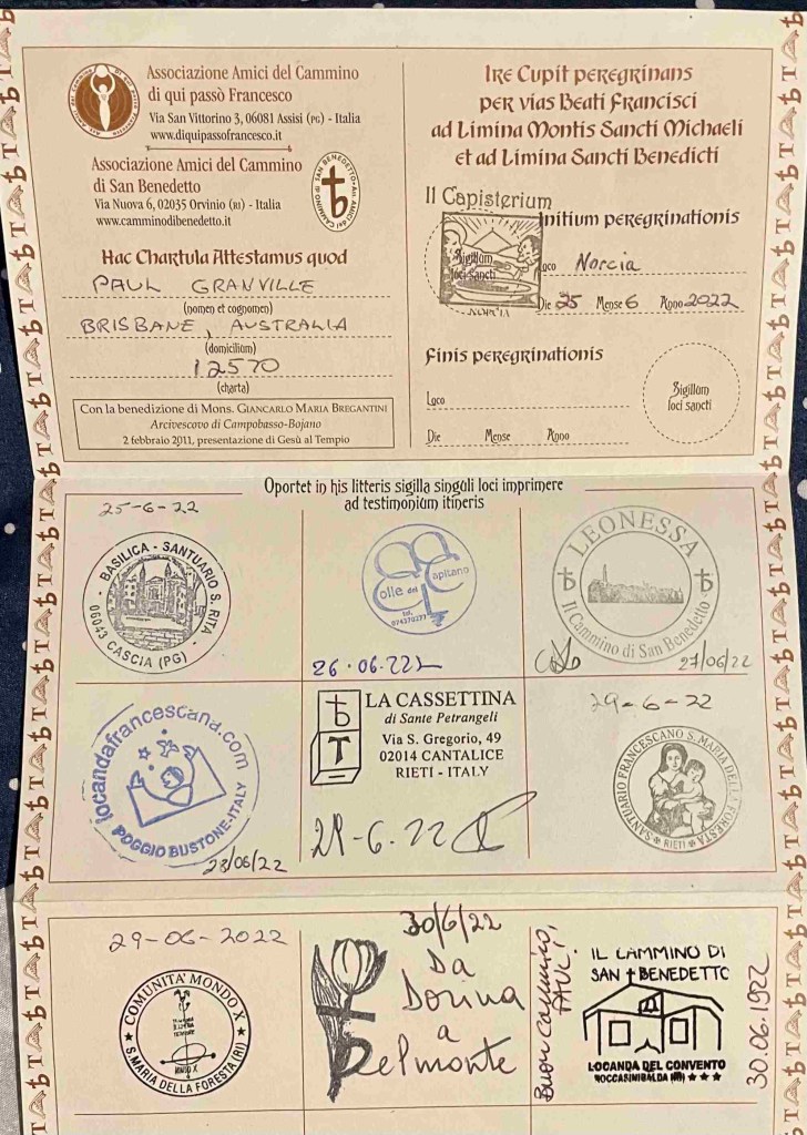
There was a sign mentioning that stamps for pilgrim credenziali or “passports” were available at a house nearby. I met Doria who runs a pay by donation hostel here. It would be a pleasant place to stop.
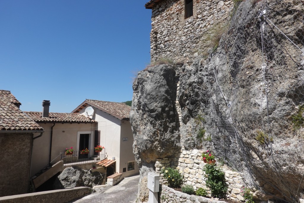
It wasn’t far then to my destination of Rocca Sinibalda. The old part of town comprises houses clinging to the edge of the huge castle.
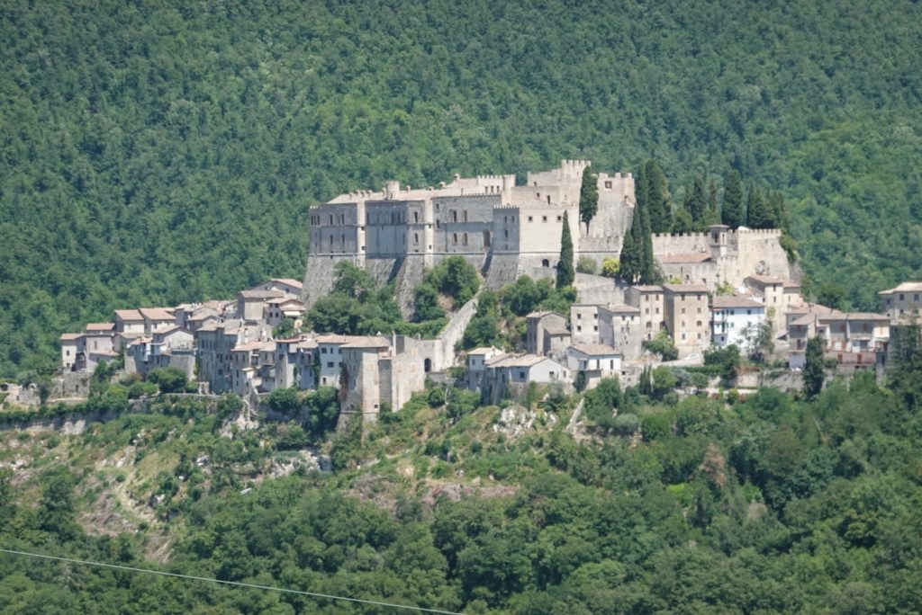
It was first built in 1084 and has incredible views up and down the valley I had walked up. In 1539, the Medici Pope Leone X gave the castle to his friend Cardinal Alessandro Cesarini who employed architect Baldassare Peruzzi to redesign it.

It is said to resemble an eagle with a beak at one end and tails at the other. It’s been fully restored but only open to group tours.

An old church with a collapsed roof still has some bright frescoes. The locals are hoping for funding to repair it.


Tomorrow I have a ‘rest day’ with a relatively short 14km walk to Castel di Tora.

So interesting reading your report of the day, thank you! I remember the way to reach Belmonte so steep, but then so beautiful!! Bravo Paul! Descrizioni perfette, complimenti! Buon cammino😘👍👋
LikeLiked by 1 person
Gracie Anna steep and slippery !
LikeLike
Bravoooooo Paul. I bet you look forward to that beer every day! And the cool wine at dinner. Good for rehydrating and replenishing those minerals 😂
>
LikeLiked by 1 person
Such a steep climb Paul but we’ll worth the effort- that lady Doria looks lovely and what a great place to sit and enjoy your lunch and a beer. Your descriptions and photos are fantastic- and greatly appreciated especially since covid made overseas travel so hard.
LikeLiked by 1 person
Thanks Vicki for being such an enthusiastic reader .
LikeLike
I am considering this trail for April 2023. Thankyou for great blog , easy reading , with relevant pics and trail.information.
LikeLiked by 1 person
Thanks. It should be wonderful in April . It’s like entering another world – so close to Rome but so far from the tourist hustle, bustle and prices .
LikeLike
Hi Paul
A question about Wikiloc.
If I I download relevant trails.from.Wikiloc.
then in Italy with phone Location.activated
Does the spot marker work, oe. move as I walk or do I need to be a.paying member ?
LikeLike
Hi . With the free version you can follow what they call Wikilog ORG profiles which are trails that companies pay to have available . I don’t know if there are any of these for the Saint Benedict route as I have the paid version. You can record your own trails with the free version. You can also download offline maps for free so you can see where you are. By the way on a few of the stages there is little coverage especially with wind3 which is what I had
LikeLiked by 1 person